|
The Walk
Park in the small car park near the plantation just off the A87, about a mile to the West of the car park is the site of the battle of Glenshiel (1719)
The walk starts with a steep climbing path heading North that initially takes you on the Western and Northern perimeter of the forestry plantation, breaking out onto the open hillside after a few hundred metres. This is quite a steep climb up grassy slopes and should there be an inckling of rain becomes very wet and boggy. The climb onto the ridge should take a good 1-1.5 hours and should bring you out at Bealach an Lapain (723m) and excellent spot for a breather offering good views across to the South Glen Shiel ridge and valley below.
Once you have completed the main climb onto the ridge, the path takes a Westerly direction along a narrow ridge from the col up to the first summit, Squrr nan Spainteach (990m). The summit here appears to have three summits, so be careful and don't be deceived with the first or second peak as being the summit. The summit is fairly rocky with high crags to its eastern face and a good amount of grass and rock not far away to the west. From here, the ridge itself should be clearly visible and the grandeur of Sgurr Fhuaran speaks for itself.
From Squrr nan Spainteach the ridge drops abruptly before the steep climb up to Sgurr na Ciste Duibhe (1027m) which should be fairly straight forward but does involve a bit of scrambling near the the summit. The summit is fairly rocky with a good amount of grass and rock not far away. Like each of the summits to come, there is a steady descent off the peak followed be a reasonable pull up to the next summit.
Continuing onwards to Sgurr na Carnach (1002m) in the North West, the second and central munro of the ridge. The path takes you in a Westerly then North Westerly direction and climbs along a broad curved ridge to the summit with the strain becoming apparent in your legs.
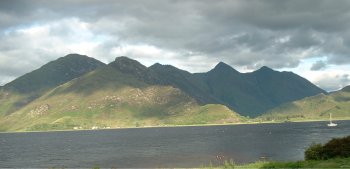
The Grandeur of Sgurr Fhuaran (1067m) should be before you, but first there is a matter of a 150m descent followed by a steep 200m pull and scramble onto its summit over a short but steep ridge. If the weather is good, you will be presented with magnificent views down Loch Duich to the west and the South Sheil Ridge to the south. The descent from Sgurr Fhuaran to Sgurr nan Saighead (929m) is by its steep narrow North Ridge and should be undertaken with care but once down the ascent to Sgurr nan Saighead is easy in comparison - just follow the narrow ridge.
The descent from Sgurr nan Saighead is quite long, approx 3 mile, and initially quite steep. There is no obvious path, but head in a Westerly direction towards the stream - Allt a'Chruinn to the left of Sgurr na Moriach (876m), this is quite boggy when wet but there is a waterfall on its steep lower slopes. Once you reach the Allt a' Chruinn, an obvious path is evident on the northern bank, follow this in a north westerly direction for approximately 1 mile towards Loch Duich.

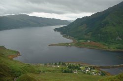
Eventually the path moves away from the river before eventually dropping down in steep descent of approximately 350m towards the road. Whilst on the descent, there are further magnificent views offered over Loch Duich and Sgurr an Airgid.
Be careful when descending here because what was a reasonable path goes into a dirt track, which again is treacherous when wet.
If the weather is fine you should have splendid views around the Glen Shiel area over to the South Shiel Ridge, Loch Duich and Ben Attow. Unfortunately when we completed this walk we had rain, sleet, snow, hail, mainly low cloud and anything else you can think of - what else would you expect on mid-summers day! It was however an extremely satisfying accomplishment.
View Photos of our weekend here.
|