|
The Walk
The walk begins at Pen-y-pass at the top of the Llanberis pass. Limited parking is available in the car park at the side of the Pen-y-pass cafe opposite the Pen-y-pass Youth Hostel. If this is full, normally after about 9:30 further off road parking is available around the junction of the A4086/A498 - approx. 1/2 mile away, or in Nant Peris, near Llanberis, and use the park and ride service.
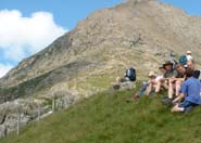
From the Pen-y-pass car park, take the track up to the right running parallel to the Llanberis Pass and to the right of one of Snowdon's arms. This is a well worn path taking you to Bwlch y Moch at the base of Crib Goch. Here you will see the start of the first, and most daunting, of the obstacles - the scramble up Crib Goch! For the faint hearted you can take the easier route along the Pyg Track going down to the left otherwise the only way is up.
The route starts as a well defined path but quickly looses this definition when you reach the base. The best way I've found is to go straight up just right of centre. It requires a bit of a climb but is quite safe providing you have good hand and foot holds. As you will see, you basically go up to the platform marking the eastern edge of the ridge and the summit of Crib Goch.
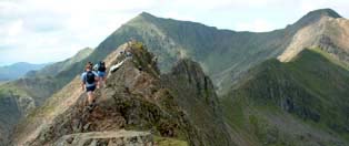
From here you can see straight along the narrow knife edged ridge, or arÍte, to the pinnacles and Bwlch Coch. The safest way across the arÍte is on the left side and don't be afraid to use your hands for stability. The views down the Llanberis Pass from here are literally breathtaking on a clear day. The arÍte lasts for 200-300 mtrs after which you come to the pinnacles. Take the first two on their left side, but climbing the third involves climbing an exposed series of steps, left to right, with a steep drop below. Once at the top of the steps descend the scree path down to Bwlch Coch.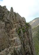
The route now follows a similar route up the ridge towards Crib y Ddysgl. Again keep on the right where you can see a path through the loose rock and scree and ensure you keep going up the ridge. When you reach the trig point at the summit of Crib y Ddysgl you have reached the summit of the second highest mountain in Snowdonia.
The path is now well defined, circling the cwm above the Glaslyn tarn, joining the Llanberis path followed quickly by the Pyg Track and railway line. Follow this well defined path onwards and upward to the summit of Yr Wyddfa, Snowdon - the highest mountain in England and Wales. Continue up to the trig point for the customary photo opportunity, but then look around at sights before you and enjoy - the Glyders over to the North East, Anglesey to the North West and Y Lliwedd to the South East
During the summer months the cafe at the end of the Snowdon mountain railway is open offering a choice of food and drink - as well as a bar.
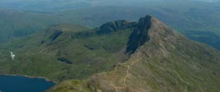
The route continues off Snowdon to Y Lliwedd in the South East for the remainder of this spectacular ridge walk. It can look daunting from here but once started, in comparison to the walk so far, can be completed with out complications.
There are several routes off the top of Snowdon, one off to the South West which joins the Watkin Path after a 100 mtrs or so, or a more direct route being a zig-zag path down the scree to also join the Watkin path near Bwlch y Saethau. Which ever you choose take care because they are both steep.
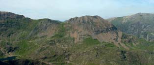
Continue along the Watkin path to a cairn at Bwlch Ciliau where the Watkin path goes down to the right and the path in front goes up towards the West Peak of Y Lliwedd. The ascent of Y Lliwedd offers excellent views across to Snowdon and Crib Goch. Follow the well defined path across the several summits and along the ridge
When you start descending off the ridge, you should see a path bearing off to the North down to Llyn Llydaw. Follow this down where it joins the Miner's Track, another route up Snowdon, following this track to the right back towards the Pen-y-pass cafe.
View Photos of our weekend here.
|